
Soubor:TabulaRogeriana.jpg
Velikost tohoto náhledu: 800 × 363 pixelů. Jiná rozlišení: 320 × 145 pixelů | 640 × 290 pixelů | 1 024 × 464 pixelů | 1 280 × 580 pixelů | 4 128 × 1 872 pixelů.
Původní soubor (4 128 × 1 872 pixelů, velikost souboru: 3,37 MB, MIME typ: image/jpeg)
| Tento soubor pochází z Wikimedia Commons. Níže jsou zobrazeny informace, které obsahuje jeho tamější stránka s popisem souboru. |
Popis
| Popis |
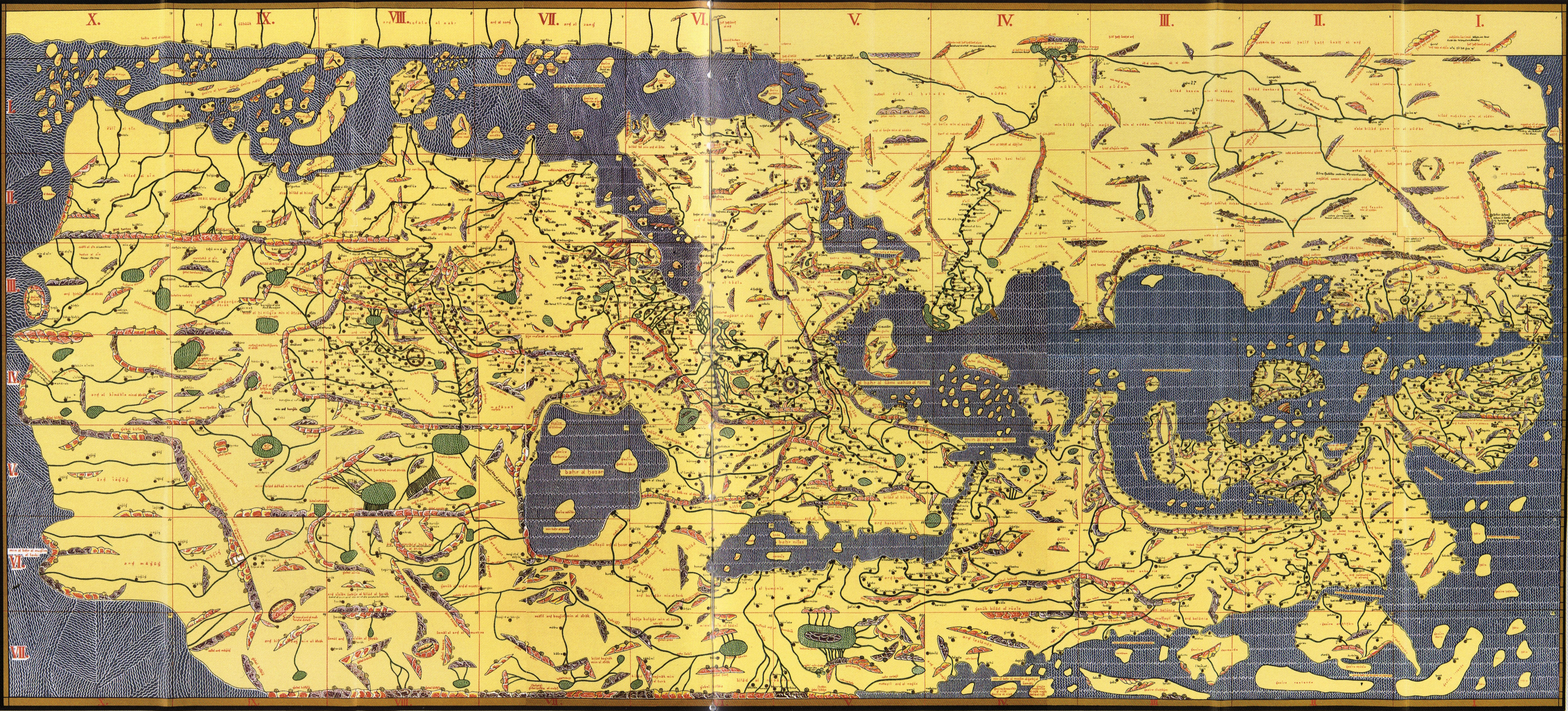
English: Copy of Al Idrisi Tabula Rogeriana with arabic names translitterated into the roman alphabet. The original has north at the bottom, so it appears "upside down". Please do not rotate it to have north at the top, as we seek to preserve the original. |
| Datum | (translitteration of arabic names by Konrad Miller, based on a 1300 (French) or 1486 (Bodleian) copy of a 1154 original) |
| Zdroj | Konrad Miller's collage of the Bodleian MS. Pococke 375 or possibly another based on the French National Library's MS. Arabe 2221 |
| Autor | Konrad Miller (copy and translitteration) |
| Další verze |
|


Licence
|
Toto je věrná fotografická reprodukce původního dvourozměrného uměleckého díla. Ono dílo je samo volným dílem, a to z následujícího důvodu:
Oficiálním stanoviskem nadace Wikimedia Foundation je, že „věrné reprodukce dvourozměrných volných děl jsou také volné a opačná tvrzení jsou útokem na samotný koncept volných děl.“ Podrobnosti naleznete na stránce Commons:When to use the PD-Art tag.
Tato fotografická reprodukce se tedy také považuje za volné dílo. Uvědomte si, že v závislosti na místních zákonech může být další užití tohoto díla ve vaší jurisdikci zakázáno či omezeno. Vizte Commons:Reuse of PD-Art photographs. | ||||
Historie souboru
Kliknutím na datum a čas se zobrazí tehdejší verze souboru.
| Datum a čas | Náhled | Rozměry | Uživatel | Komentář | |
|---|---|---|---|---|---|
| současná | 7. 9. 2013, 21:18 | | 4 128 × 1 872 (3,37 MB) | Denniss | lossles rotation of original upload |
| 25. 5. 2009, 03:33 |  | 4 135 × 1 875 (2,86 MB) | Hopefully acceptable username~commonswiki | Rotated 180 degrees, North in this map is at the bottom, as can be seen by reading row and column names or any other label. | |
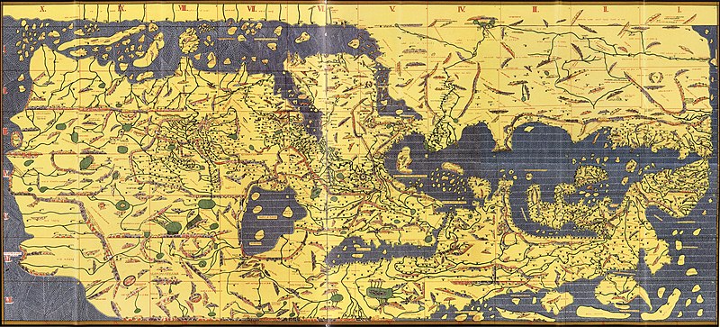
| 23. 11. 2007, 22:47 |  | 4 135 × 1 875 (3,45 MB) | World Imaging | {{Information |Description=Tabula Rogeriana, 1154 |Source=Bibliotheque Nationale de France (MSO Arable 2221) |Date=1154 |Author=Al-Idrisi |Permission= |other_versions= }} |
Využití souboru
Tento soubor používá následujících 9 stránek:
Globální využití souboru
Tento soubor využívají následující wiki:
- Využití na als.wikipedia.org
- Využití na ar.wikipedia.org
- Využití na bn.wikipedia.org
- Využití na bs.wikipedia.org
- Využití na ca.wikipedia.org
- Využití na ckb.wikipedia.org
- Využití na da.wikipedia.org
- Využití na de.wikipedia.org
- Využití na en.wikipedia.org
- Využití na en.wiktionary.org
- Využití na es.wikipedia.org
- Využití na et.wikipedia.org
- Využití na eu.wikipedia.org
- Využití na fi.wikipedia.org
- Využití na fr.wikipedia.org
- Liste des ports antiques
- Berbera
- Al Idrissi
- Maghreb central
- Culture de la Sicile normande
- Histoire de la cartographie
- Tabula Rogeriana
- Géographie et cartographie dans le monde arabo-musulman médiéval
- Royaume d'Afrique
- Wikipédia:Le Bistro/24 mai 2018
- XIIe siècle en science
- Utilisateur:Witcher of Izalith/Galeries d'Izalith
- Využití na fr.wikiversity.org
Zobrazit další globální využití tohoto souboru.