
Soubor:NPS big-bend-simple-map.gif

Velikost tohoto náhledu: 800 × 574 pixelů. Jiná rozlišení: 320 × 230 pixelů | 640 × 460 pixelů | 1 024 × 735 pixelů | 1 280 × 919 pixelů | 1 795 × 1 289 pixelů.
Původní soubor (1 795 × 1 289 pixelů, velikost souboru: 272 KB, MIME typ: image/gif, 0,1 s)
| Tento soubor pochází z Wikimedia Commons. Níže jsou zobrazeny informace, které obsahuje jeho tamější stránka s popisem souboru. |
Popis
| Popis |
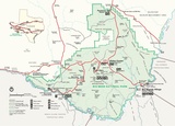
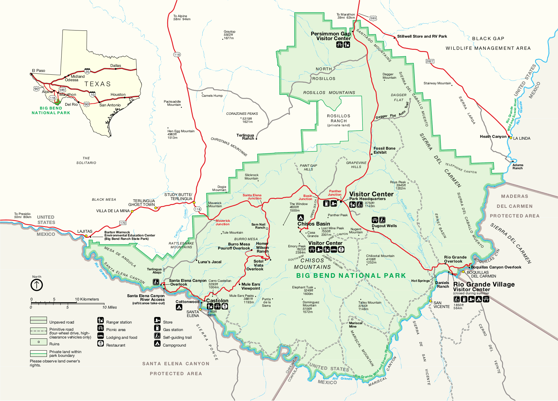
English: Simple map of Big Bend from the park newspaper. It’s easier to read and print than the official map above. |
| Datum | |
| Zdroj | U.S. National Park Service (http://npmaps.com/wp-content/uploads/big-bend-simple-map.gif) |
| Autor | U.S. National Park Service, restoration/cleanup by Matt Holly |
| Další verze |
 |
Licence
| This image or media file contains material based on a work of a National Park Service employee, created as part of that person's official duties. As a work of the U.S. federal government, such work is in the public domain in the United States. See the NPS website and NPS copyright policy for more information. |
Historie souboru
Kliknutím na datum a čas se zobrazí tehdejší verze souboru.
| Datum a čas | Náhled | Rozměry | Uživatel | Komentář | |
|---|---|---|---|---|---|
| současná | 16. 5. 2017, 17:27 | | 1 795 × 1 289 (272 KB) | RKBot | =={{int:filedesc}}== {{Information |description= {{en|1=Simple map of Big Bend from the park newspaper. It’s easier to read and print than the official map above.}} |date= 2013-11-12 |source= U.S. National Park Service (http://npmaps.com/wp-content/u... |
Využití souboru
Tento soubor používá následující stránka: