
Soubor:Irma 2017-09-05 1706Z.jpg
Velikost tohoto náhledu: 450 × 600 pixelů. Jiná rozlišení: 180 × 240 pixelů | 360 × 480 pixelů | 576 × 768 pixelů | 768 × 1 024 pixelů | 1 536 × 2 048 pixelů | 4 950 × 6 600 pixelů.
Původní soubor (4 950 × 6 600 pixelů, velikost souboru: 8,39 MB, MIME typ: image/jpeg)
| Tento soubor pochází z Wikimedia Commons. Níže jsou zobrazeny informace, které obsahuje jeho tamější stránka s popisem souboru. |
Popis
| Popis |
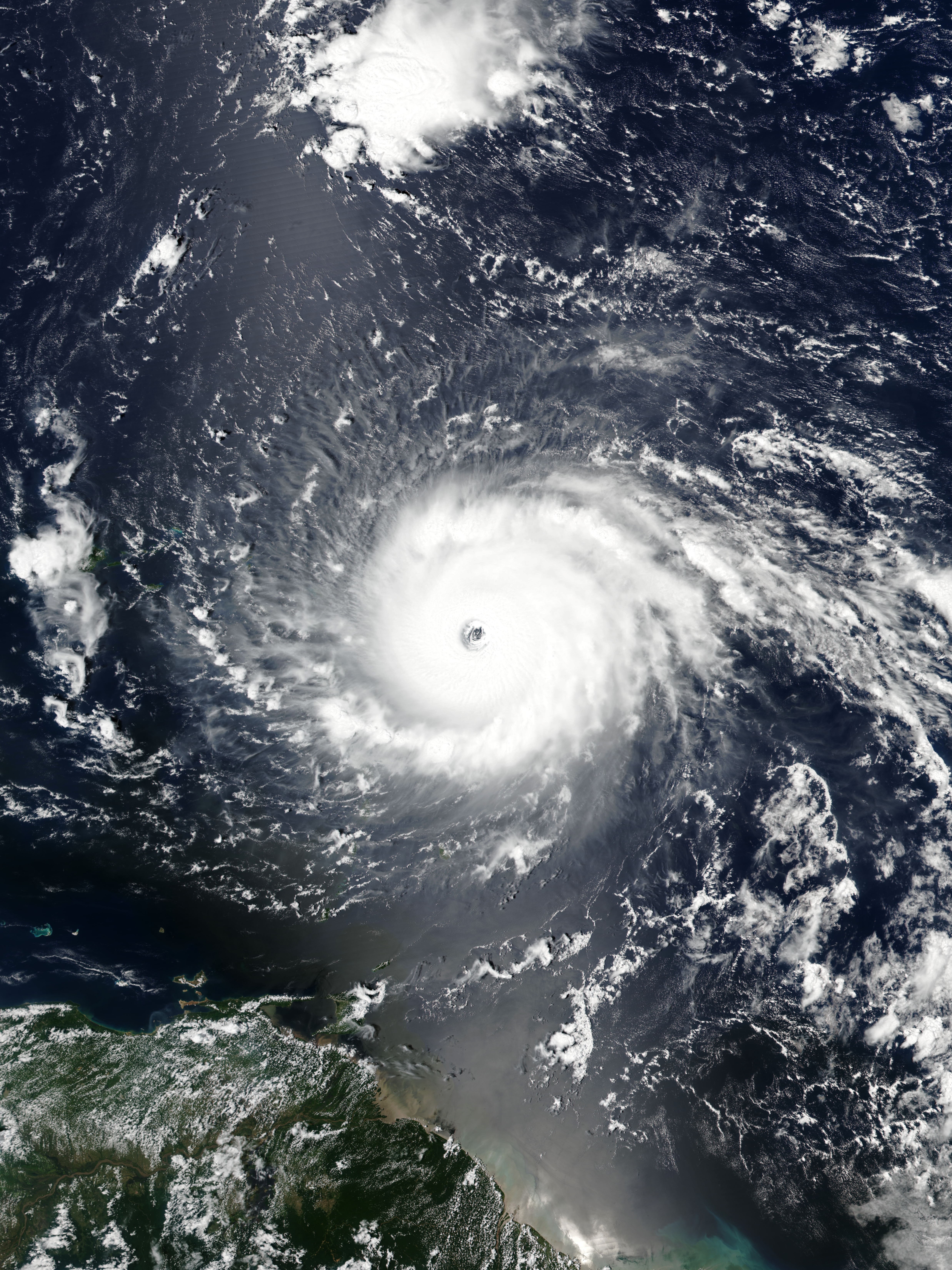
English: Hurricane Irma approaching the Leeward Islands at peak intensity on September 5, 2017 as the third most intense Atlantic hurricane on record in terms of sustained winds. |
| Datum | |
| Zdroj | EOSDIS Worldview |
| Autor | VIIRS image captured by NOAA’s Suomi NPP satellite |
| Pozice fotografa | | Tento snímek a mnohé další na: OpenStreetMap |
|---|
Licence
| This file is in the public domain in the United States because it was solely created by NASA. NASA copyright policy states that "NASA material is not protected by copyright unless noted". (See Template:PD-USGov, NASA copyright policy page or JPL Image Use Policy.) | ||
 |
Warnings:
|
Historie souboru
Kliknutím na datum a čas se zobrazí tehdejší verze souboru.
| Datum a čas | Náhled | Rozměry | Uživatel | Komentář | |
|---|---|---|---|---|---|
| současná | 15. 5. 2021, 03:21 | | 4 950 × 6 600 (8,39 MB) | Supportstorm | Reverted to version as of 21:19, 5 September 2017 (UTC) |
| 15. 5. 2021, 02:12 |  | 437 × 452 (89 KB) | Super Cyclonic Storm Corona | Crop a bit. | |
| 5. 9. 2017, 23:19 |  | 4 950 × 6 600 (8,39 MB) | Meow | User created page with UploadWizard |
Využití souboru
Tento soubor používá následující stránka:
Globální využití souboru
Tento soubor využívají následující wiki:
- Využití na en.wikipedia.org
- Portal:Tropical cyclones/Anniversaries/September
- Portal:Tropical cyclones/Anniversaries/September/5
- User:LightandDark2000/My Notable Storms
- Talk:Hurricane Irma/Archive 2
- User:Tfmbty/List of the most intense tropical cyclones since 1979
- User talk:36.82.216.113
- Talk:2018 Atlantic hurricane season/Archive 2
- User talk:82.8.147.67
- Využití na es.wikipedia.org
- Využití na et.wikipedia.org
- Využití na hu.wikipedia.org
- Využití na pt.wikipedia.org
- Využití na ru.wikipedia.org
- Využití na sd.wikipedia.org
- Využití na sr.wikipedia.org
- Využití na th.wikipedia.org
- Využití na uk.wikipedia.org
- Využití na uz.wikipedia.org
- Využití na zh.wikipedia.org