
Soubor:Corte Madera California aerial view.jpg

Velikost tohoto náhledu: 800 × 534 pixelů. Jiná rozlišení: 320 × 214 pixelů | 640 × 427 pixelů | 1 024 × 683 pixelů | 1 500 × 1 001 pixelů.
Původní soubor (1 500 × 1 001 pixelů, velikost souboru: 807 KB, MIME typ: image/jpeg)
| Tento soubor pochází z Wikimedia Commons. Níže jsou zobrazeny informace, které obsahuje jeho tamější stránka s popisem souboru. |
| Popis |
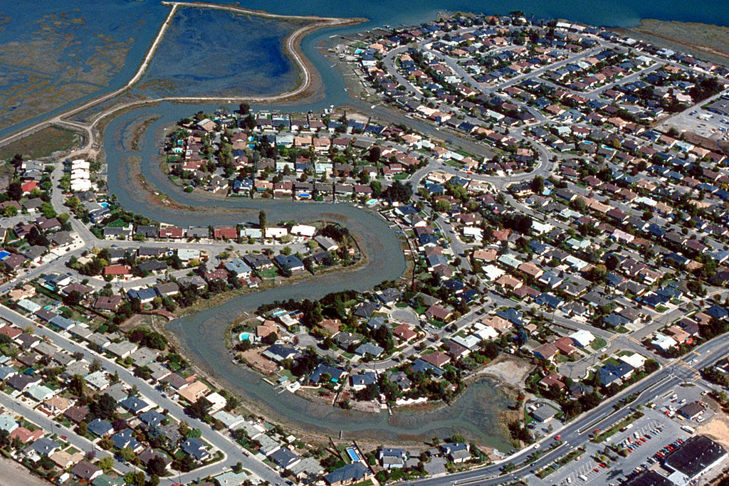
English: Aerial view of the Meadowsweet area of Corte Madera, California, USA. The city lies on the western side of upper San Francisco Bay. San Clemente Creek winds through the neighborhood. Paradise Drive is visible at the bottom of the picture. View is to the northeast.
Coordinates: 37°55′20.21″N 122°30′14.16″W / 37.9222806°N 122.5039333°W |
|||
| Umístění | Corte Madera, California, USA | |||
| Datum | not specified or unknown | |||
| Zdroj |
U.S. Army Corps of Engineers Digital Visual Library Image page Image description page Digital Visual Library home page |
|||
| Autor | Robert Campbell, U.S. Army Corps of Engineers | |||
| Svolení (Užití tohoto souboru) |
|
Historie souboru
Kliknutím na datum a čas se zobrazí tehdejší verze souboru.
| Datum a čas | Náhled | Rozměry | Uživatel | Komentář | |
|---|---|---|---|---|---|
| současná | 3. 5. 2007, 03:57 | | 1 500 × 1 001 (807 KB) | DanMS | {{Information | Description = {{en|Aerial view of the Meadowsweet area of Corte Madera, California, USA. The city lies on the western side of upper San Francisco Bay. San Clemente Creek winds through the neighborhood. Paradise Drive is visible at the b |
Využití souboru
Tento soubor používá následující stránka:
Globální využití souboru
Tento soubor využívají následující wiki:
- Využití na ar.wikipedia.org
- Využití na bg.wikipedia.org
- Využití na en.wikipedia.org
- Využití na es.wikipedia.org
- Využití na fa.wikipedia.org
- Využití na it.wikipedia.org
- Využití na pl.wikipedia.org
- Využití na pt.wikipedia.org
- Využití na sh.wikipedia.org
- Využití na sr.wikipedia.org
- Využití na uz.wikipedia.org