
Soubor:Confederation of the Rhine (1812).svg

Velikost tohoto PNG náhledu tohoto SVG souboru: 450 × 456 pixelů. Jiná rozlišení: 237 × 240 pixelů | 474 × 480 pixelů | 758 × 768 pixelů | 1 011 × 1 024 pixelů | 2 021 × 2 048 pixelů.
Původní soubor (soubor SVG, nominální rozměr: 450 × 456 pixelů, velikost souboru: 611 KB)
| Tento soubor pochází z Wikimedia Commons. Níže jsou zobrazeny informace, které obsahuje jeho tamější stránka s popisem souboru. |
Popis


.svg)
.svg)
.svg)
.svg)
.svg)


.svg)
.svg)
.svg)


.png)
.png)


.svg)


.svg)

.svg)


.svg)
.svg)
.svg)
.svg)


.svg)
.png)


.svg)


.svg)
.svg)


.svg)


.svg)


.svg)
.svg)
.svg)
.svg)
.svg)
.svg)
.svg)
.svg)
_cropped.svg)
.svg)
.svg)
.svg)
.svg)
.svg)
.svg)
.svg)
.svg)
.svg)
.svg)
.svg)
.svg)
.svg)
.svg)
.svg)
.svg)
.svg)
.svg)
.svg)
.svg)
.svg)
.svg)
.svg)
.svg)
.svg)
.svg)
.svg)
.svg)
.svg)
.svg)
.svg)
.svg)
.svg)
.svg)
.svg)
.svg)
.svg)
.svg)
.svg)
.svg)
.svg)
.svg)
.svg)
.svg)
.svg)
Historie souboru
Kliknutím na datum a čas se zobrazí tehdejší verze souboru.
| Datum a čas | Náhled | Rozměry | Uživatel | Komentář | |
|---|---|---|---|---|---|
| současná | 5. 1. 2018, 16:59 | | 450 × 456 (611 KB) | TRAJAN 117 | +++ |
| 3. 10. 2013, 17:35 |  | 450 × 456 (607 KB) | Alphathon | Added constituent states | |
| 30. 7. 2012, 20:34 |  | 450 × 456 (464 KB) | Alphathon | Fixed some principalities | |
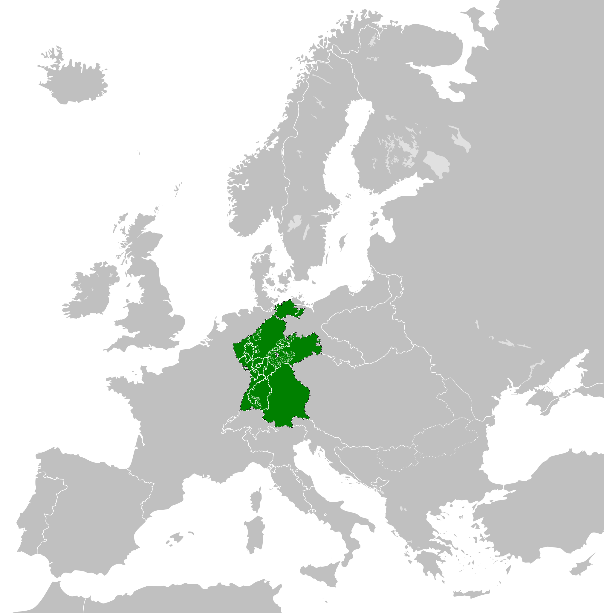
| 23. 2. 2012, 19:07 |  | 450 × 456 (444 KB) | TRAJAN 117 | {{Information |Description ={{en|1=The Confederation of the Rhine in 1812.}} |Source ={{own}} {{AttribSVG|First French Empire 1812.svg|Alphathon}} |Author =25px '''[[User:TRAJAN 117|TRAJAN 1... |
Využití souboru
Tento soubor používá následující stránka:
Globální využití souboru
Tento soubor využívají následující wiki:
- Využití na ast.wikipedia.org
- Využití na azb.wikipedia.org
- Využití na be.wikipedia.org
- Využití na da.wikipedia.org
- Využití na de.wikipedia.org
- Využití na el.wikipedia.org
- Využití na en.wikipedia.org
- Využití na es.wikipedia.org
- Využití na eu.wikipedia.org
- Využití na fi.wikipedia.org
- Využití na gd.wikipedia.org
- Využití na gl.wikipedia.org
- Využití na he.wikipedia.org
- Využití na hr.wikipedia.org
- Využití na hu.wikipedia.org
- Využití na id.wikipedia.org
- Využití na it.wikipedia.org
- Využití na ja.wikipedia.org
- Využití na ko.wikipedia.org
- Využití na lt.wikipedia.org
- Využití na lv.wikipedia.org
- Využití na mk.wikipedia.org
- Využití na mn.wikipedia.org
- Využití na ms.wikipedia.org
- Využití na pl.wikipedia.org
- Využití na pt.wikipedia.org
- Využití na ru.wikipedia.org
- Využití na sco.wikipedia.org
- Využití na sk.wikipedia.org
- Využití na sl.wikipedia.org
- Využití na sv.wikipedia.org
- Využití na th.wikipedia.org
- Využití na tr.wikipedia.org
- Využití na www.wikidata.org
- Využití na zh-yue.wikipedia.org
- Využití na zh.wikipedia.org
.svg)