
Soubor:Albania location map.svg

Velikost tohoto PNG náhledu tohoto SVG souboru: 411 × 599 pixelů. Jiná rozlišení: 165 × 240 pixelů | 329 × 480 pixelů | 527 × 768 pixelů | 703 × 1 024 pixelů | 1 406 × 2 048 pixelů | 688 × 1 002 pixelů.
Původní soubor (soubor SVG, nominální rozměr: 688 × 1 002 pixelů, velikost souboru: 168 KB)
| Tento soubor pochází z Wikimedia Commons. Níže jsou zobrazeny informace, které obsahuje jeho tamější stránka s popisem souboru. |
Popis
| Popis |
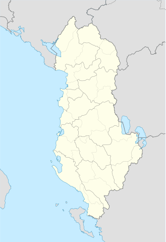
Deutsch: Positionskarte von Albanien
Quadratische Plattkarte, N-S-Streckung 130 %. Geographische Begrenzung der Karte:
English: Location map of Albania
Equirectangular projection, N/S stretching 130 %. Geographic limits of the map:
|
||
| Datum | |||
| Zdroj | Vlastní dílo pomocí: United States National Imagery and Mapping Agency data | ||
| Autor | Lencer | ||
| SVG vývoj | Tento vektorový obrázek byl vytvořen programem Adobe Illustrator
|

Licence
Já, držitel autorských práv k tomuto dílu, ho tímto zveřejňuji za podmínek následujících licencí:

|
Tento dokument smí být kopírován, šířen nebo upravován podle podmínek Svobodné licence GNU pro dokumenty verze 1.2 nebo libovolné vyšší verze publikované nadací Free Software Foundation. Dokument nemá neměnné části ani texty na předním či zadním přebalu. Kopie textu licence je k dispozici v oddíle nazvaném GNU Free Documentation License. |
Tento soubor podléhá licenci Creative Commons Uveďte autora-Zachovejte licenci 3.0 Unported.
- Dílo smíte:
- šířit – kopírovat, distribuovat a sdělovat veřejnosti
- upravovat – pozměňovat, doplňovat, využívat celé nebo částečně v jiných dílech
- Za těchto podmínek:
- uveďte autora – Máte povinnost uvést autorství, poskytnout odkaz na licenci a uvést, pokud jste provedli změny. Toho můžete docílit jakýmkoli rozumným způsobem, avšak ne způsobem naznačujícím, že by poskytovatel licence schvaloval nebo podporoval vás nebo vaše užití díla.
- zachovejte licenci – Pokud tento materiál jakkoliv upravíte, přepracujete nebo použijete ve svém díle, musíte své příspěvky šířit pod stejnou nebo slučitelnou licencí jako originál.
Můžete si zvolit libovolnou z těchto licencí.
Historie souboru
Kliknutím na datum a čas se zobrazí tehdejší verze souboru.
| Datum a čas | Náhled | Rozměry | Uživatel | Komentář | |
|---|---|---|---|---|---|
| současná | 20. 6. 2011, 20:16 | | 688 × 1 002 (168 KB) | Vinie007 | fix districts |
| 22. 3. 2010, 21:56 |  | 685 × 1 002 (152 KB) | NordNordWest | counties | |
| 22. 3. 2010, 21:06 |  | 685 × 1 002 (162 KB) | NordNordWest | update | |
| 11. 9. 2008, 17:27 |  | 685 × 1 002 (278 KB) | Lencer | {{Information |Description= |Source= |Date= |Author= |Permission= |other_versions= }} | |
| 9. 9. 2008, 19:36 |  | 685 × 1 002 (278 KB) | Lencer | {{Information |Description= |Source= |Date= |Author= |Permission= |other_versions= }} | |
| 16. 8. 2008, 13:14 |  | 685 × 1 002 (279 KB) | Lencer | {{Information |Description= |Source= |Date= |Author= |Permission= |other_versions= }} | |
| 21. 7. 2008, 18:00 |  | 258 × 377 (254 KB) | Lencer | {{Information |Description= |Source= |Date= |Author= |Permission= |other_versions= }} | |
| 21. 7. 2008, 17:42 |  | 258 × 377 (254 KB) | Lencer | {{Information |Description= {{de|Positionskarte von Albanien}} Quadratische Plattkarte, N-S-Streckung 130 %. Geographische Begrenzung der Karte: * N: 42.9° N * S: 39.3° N * W: 18.3° O * O: 21.5° O {{en|Location map of [[:en:Al |
Využití souboru
Tento soubor nepoužívá žádná stránka.
Globální využití souboru
Tento soubor využívají následující wiki:
- Využití na ar.wikipedia.org
- Využití na bn.wikipedia.org
- Využití na bs.wikipedia.org
- Využití na ca.wikipedia.org
- Využití na ceb.wikipedia.org
- Albanya
- Plantilya:Location map Albania
- Puka
- Krabi
- Komsi
- Kalja
- Kala
- Golo
- Kusha
- Tok
- Raba
- Paula
- Kota
- Korab
- Orle
- Bistrica
- Tumba
- Mali i Zi
- Guri i Zi
- Veternik
- Selce
- Propas
- Petran
- Dibra
- Osoj
- Ostrovica
- Miras
- Mali Grad
- Mala Reka
- Lofka
- Lisec
- Lipec
- Leska
- Lomnica
- Kraste
- Krasta
- Kovacica
- Gorica
- Maja e Kodres
- Klisura
- Belica
Zobrazit další globální využití tohoto souboru.